Wachtwoord kwijt? Nieuwe gebruiker? Registeren
Lizard fish, Philippines. Photo by Stephane Rochon.
Enjoy and contribute!
| Zoek de beste duiklocaties |
|
|
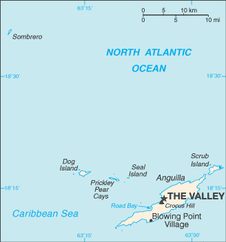
 Anguilla
Centraal-Amerika
Locatie: Caribbean, islands between the Caribbean Sea and North Atlantic Ocean, east of Puerto Rico
Geografische coordinaten: 18° 15' N, 63° 10' W
Kustlijn km: 61 km km
Klimaat: tropical; moderated by northeast trade winds
Terrein: flat and low-lying island of coral and limestone
Hoogte: lowest point: Caribbean Sea 0 m
highest point: Crocus Hill 65 m
Natuurlijke gevaren: frequent hurricanes and other tropical storms (July to October)
Valuta: East Caribbean dollar (XCD)
Populatie: 13,677 (July 2007 est.)
Talen: English (official)
Hoofdstad: The Valley
Provincies: none (overseas territory of the UK)
Meer details
| Jan | Feb | Mar | Apr | May | Jun | Jul | Aug | Sep | Oct | Nov | Dec | |
|---|---|---|---|---|---|---|---|---|---|---|---|---|
| Climate | ||||||||||||
| Air temp. | ||||||||||||
| Water temp. | ||||||||||||
| Equipment | Don't know | Don't know | Don't know | Don't know | Don't know | Don't know | Don't know | Don't know | Don't know | Don't know | Don't know | Don't know |
| Best season | ||||||||||||
Extra kaart
Wil je info toevoegen over Anguilla? Laat ons weten...
Dit is een interactieve kaart! Gebruik "controls" voor pan and zoom op deze kaart.
- Favoriet
-
Je favoriete and toekomst duiklocatie lijst
Duiklocatie
| Duiklocatie (21) | Kwaliteit | Gem diepte | Max diepte | Ervaring | Duik type | ||
|---|---|---|---|---|---|---|---|
| Angel Reef | - / - | 15 m | 19.8 m | Alle duikers | 
|
||
| Anguillita | - / - | 10.7 m | 18.3 m | CMAS * / OW | 
|
||
| Beacon | - / - | 15 m | 21.3 m | Alle duikers |
|
||
| Blowing Rock | - / - | 9.1 m | 12.2 m | Alle duikers | 

|
||
| Captain Turtle | - / - | 15 m | 19.8 m | Alle duikers |
|
||
| Crystal Reef | - / - | 16.5 m | 25 m | CMAS * / OW |
|
||
| Dog Island | - / - | 20 m | 30.5 m | CMAS ** / AOW | 
|
||
| Frenchman's Reef | - / - | 20 m | 30.5 m | CMAS * / OW |
|
||
| Lobster Reef | - / - | 18 m | 30.5 m | Alle duikers |
|
||
| MV Catheley H Wreck | - / - | 10.7 m | 18.3 m | Alle duikers |
|
||
| MV Commerce | - / - | 20 m | 25 m | CMAS * / OW | 
|
||
| MV Ida Maria Wreck | - / - | 12.2 m | 18.3 m | CMAS * / OW |
|
||
| MV Oosterdiep | - / - | 24.4 m | 25 m | Alle duikers |
|
||
| MV Sarah | - / - | 20 m | 25.9 m | CMAS * / OW |
|
||
| No Name Reef | 1 / - | 12.2 m | 16.8 m | Alle duikers |
|
||
| Prickly Pear | - / - | 5 m | 17 m | Alle duikers |
|
||
| Sea Fan | - / - | 10 m | 12.2 m | Alle duikers |
|
||
| Shoal Bay Reef | - / - | 18 m | 25.9 m | Alle duikers |
|
||
| Teigland | - / - | 15 m | 21 m | Alle duikers |
|
||
| The Garden | - / - | 25 m | 34.1 m | CMAS * / OW |
|
||
| West Cay | - / - | 15 m | 32 m | CMAS * / OW |
|

 Duiklogs
|
Duiktrips
|
Comments
Fouten, Feedback
Als je nieuwe informatie wilt toevoegen of fouten van dit land wilt herstellen, Stuur ons feedback.
Adverteer
Wannadive.net 24/24
Wannadive.net op jouw mobiel
![]()
RSS Alle RSS feeds van Wannadive.net
Nieuwsbrief Alle nieuws per E-mail