Wachtwoord kwijt? Nieuwe gebruiker? Registeren
Clownfish, Philippines. Photo by Stephane Rochon.
Enjoy and contribute!
| Zoek de beste duiklocaties |
|
|
 India
India
Azie
Locatie: Southern Asia, bordering the Arabian Sea and the Bay of Bengal, between Burma and Pakistan
Geografische coordinaten: 20° 0' N, 77° 0' E
Kustlijn km: 7,000 km km
Klimaat: varies from tropical monsoon in south to temperate in north
Terrein: upland plain (Deccan Plateau) in south, flat to rolling plain along the Ganges, deserts in west, Himalayas in north
Hoogte:
Natuurlijke gevaren: droughts; flash floods, as well as widespread and destructive flooding from monsoonal rains; severe thunderstorms; earthquakes
Valuta: Indian rupee (INR)
Populatie:
Talen: English enjoys associate status but is the most important language for national, political, and commercial communication; Hindi is the national language and primary tongue of 30% of the people
Hoofdstad:
Provincies:
Meer details
| Jan | Feb | Mar | Apr | May | Jun | Jul | Aug | Sep | Oct | Nov | Dec | |
|---|---|---|---|---|---|---|---|---|---|---|---|---|
| Climate | ||||||||||||
| Air temp. | ||||||||||||
| Water temp. | ||||||||||||
| Equipment | ||||||||||||
| Best season | ||||||||||||
Wil je info toevoegen over India? Laat ons weten...
Dit is een interactieve kaart! Gebruik "controls" voor pan and zoom op deze kaart.

- Favoriet
-
Je favoriete and toekomst duiklocatie lijst
Je favoriete zone staat niet in het overzicht? Zone toevoegen
Zones
| Zones (3) | Duiklocatie | Sub zones |
|---|---|---|
| Andaman Islands | 2 | 0 |
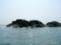
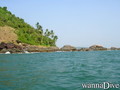
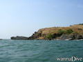
| Goa | 3 | 0 |
| South India | 2 | 1 |
 Duiklogs
|
Duiktrips
|
Comments
Wees de eerste en becommentarieer dit land
Fouten, Feedback
Als je nieuwe informatie wilt toevoegen of fouten van dit land wilt herstellen, Stuur ons feedback.
Adverteer
Wannadive.net 24/24
Wannadive.net op jouw mobiel
![]()
RSS Alle RSS feeds van Wannadive.net
Nieuwsbrief Alle nieuws per E-mail