Wachtwoord kwijt? Nieuwe gebruiker? Registeren
Lizard fish, Philippines. Photo by Stephane Rochon.
Enjoy and contribute!
| Zoek de beste duiklocaties |
|
|
 Estonia
Europa
Locatie: Eastern Europe, bordering the Baltic Sea and Gulf of Finland, between Latvia and Russia
Geografische coordinaten: 59° 0' N, 26° 0' E
Kustlijn km: 3,794 km km
Klimaat: maritime, wet, moderate winters, cool summers
Terrein: marshy, lowlands; flat in the north, hilly in the south
Hoogte: lowest point: Baltic Sea 0 m
highest point: Suur Munamagi 318 m
Natuurlijke gevaren: sometimes flooding occurs in the spring
Valuta: Estonian kroon (EEK)
Populatie: 1,315,912 (July 2007 est.)
Talen: Estonian (official) 67.3%, Russian 29.7%, other 2.3%, unknown 0.7% (2000 census)
Hoofdstad: Tallinn
Provincies: 15 counties (maakonnad, singular - maakond): Harjumaa (Tallinn), Hiiumaa (Kardla), Ida-Virumaa (Johvi), Jarvamaa (Paide), Jogevamaa (Jogeva), Laanemaa (Haapsalu), Laane-Virumaa (Rakvere), Parnumaa (Parnu), Polvamaa (Polva), Raplamaa (Rapla), Saaremaa (Kuressaare), Tartumaa (Tartu), Valgamaa (Valga), Viljandimaa (Viljandi), Vorumaa (Voru)
Meer details
| Jan | Feb | Mar | Apr | May | Jun | Jul | Aug | Sep | Oct | Nov | Dec | |
|---|---|---|---|---|---|---|---|---|---|---|---|---|
| Climate | ||||||||||||
| Air temp. | ||||||||||||
| Water temp. | ||||||||||||
| Equipment | ||||||||||||
| Best season | ||||||||||||
Wil je info toevoegen over Estonia? Laat ons weten...
Dit is een interactieve kaart! Gebruik "controls" voor pan and zoom op deze kaart.
- Favoriet
-
Je favoriete and toekomst duiklocatie lijst
Duiklocatie
| Duiklocatie (4) | Kwaliteit | Gem diepte | Max diepte | Ervaring | Duik type | ||
|---|---|---|---|---|---|---|---|
| Äntu Sinijärv | - / - | 9.8 ft | 26.2 ft | Alle duikers | 

|
||
| Äntu Valgejärv | - / - | 9.8 ft | 16.4 ft | Alle duikers |
|
||
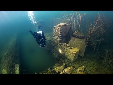
| Hara submarine harbour | 2 / - | 32.8 ft | 39.4 ft | CMAS * / OW | 


|
||
| Rummu Quarry | - / 2 | 49.2 ft | 65.6 ft | Alle duikers |
|


 Comments
Fouten, Feedback
Als je nieuwe informatie wilt toevoegen of fouten van dit land wilt herstellen, Stuur ons feedback.
Adverteer
Wannadive.net 24/24
Wannadive.net op jouw mobiel
![]()
RSS Alle RSS feeds van Wannadive.net
Nieuwsbrief Alle nieuws per E-mail