Wachtwoord kwijt? Nieuwe gebruiker? Registeren
Clownfish, Philippines. Photo by Stephane Rochon.
Enjoy and contribute!
| Zoek de beste duiklocaties |
|
|
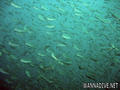
 Brunei
Azie
Mainly known for its wrecks and oil platforms.
Locatie: Southeastern Asia, bordering the South China Sea and Malaysia
Geografische coordinaten: 4° 30' N, 114° 40' E
Kustlijn km: 161 km km
Klimaat: tropical; hot, humid, rainy
Terrein: flat coastal plain rises to mountains in east; hilly lowland in west
Hoogte: lowest point: South China Sea 0 m
highest point: Bukit Pagon 1,850 m
Natuurlijke gevaren: typhoons, earthquakes, and severe flooding are rare
Valuta: Bruneian dollars (BND)
Populatie: 388,190 (July 2009 est.)
Talen: Malay (official), English, Chinese
Hoofdstad: Bandar Seri Begawan
Provincies: 4 districts (daerah-daerah, singular - daerah); Belait, Brunei and Muara, Temburong, Tutong
Meer details
| Jan | Feb | Mar | Apr | May | Jun | Jul | Aug | Sep | Oct | Nov | Dec | |
|---|---|---|---|---|---|---|---|---|---|---|---|---|
| Climate | ||||||||||||
| Air temp. | ||||||||||||
| Water temp. | ||||||||||||
| Equipment | No ho sé | No ho sé | No ho sé | No ho sé | No ho sé | No ho sé | No ho sé | No ho sé | No ho sé | No ho sé | No ho sé | No ho sé |
| Best season | ||||||||||||
Wil je info toevoegen over Brunei? Laat ons weten...
Dit is een interactieve kaart! Gebruik "controls" voor pan and zoom op deze kaart.
- Favoriet
-
Je favoriete and toekomst duiklocatie lijst
Duiklocatie
| Duiklocatie (7) | Kwaliteit | Gem diepte | Max diepte | Ervaring | Duik type | ||
|---|---|---|---|---|---|---|---|
| Blue Water Wreck | - / - | 30 m | 35 m | CMAS *** / Rescue | 
|
||
| Bolkiah Wreck | 3 / - | 18 m | 20 m | CMAS * / OW |
|
||
| Pelong Rocks | - / - | 10 m | 15 m | Alle duikers | 
|
||
| The American Wreck | - / - | 25 m | 30 m | CMAS ** / AOW |
|
||
| The Australian Wreck | - / - | 25 m | 33 m | CMAS ** / AOW |
|
||
| The Cement Wreck | - / - | 20 m | 32 m | CMAS ** / AOW |
|
||
| Yuho Maru Wreck | - / - | 45 m | 55 m | CMAS *** / DiveMaster |

|


 Comments
Fouten, Feedback
Als je nieuwe informatie wilt toevoegen of fouten van dit land wilt herstellen, Stuur ons feedback.
Adverteer
Wannadive.net 24/24
Wannadive.net op jouw mobiel
![]()
RSS Alle RSS feeds van Wannadive.net
Nieuwsbrief Alle nieuws per E-mail